STEAM Engine
UCF researchers are driving science’s next generation through the nation’s first mobile geospatial technology learning lab.


UCF researchers are driving science’s next generation through the nation’s first mobile geospatial technology learning lab.
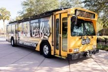
Aboard a typical city bus, you’ll find passengers en route to destinations near and far. On this repurposed LYNX city bus, you’ll find kids discovering the hands-on science of geospatial technologies.
Since 2015, Citizen Science GIS, a global research organization based at UCF, has united scientists and society through geographic information system (GIS) technologies to better serve communities in need. Now, the organization is connecting K-12 students to science, technology, engineering, arts and math (STEAM) beyond the classroom through its GeoBus.
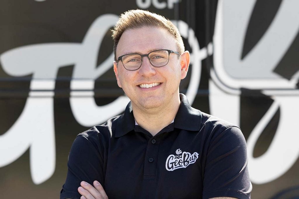
“What was so meaningful was people seeing a vision, believing in and supporting us in it,” says Tim Hawthorne, a UCF associate professor and founder of Citizen Science GIS and the GeoBus. “They believed in it because it was centered on the kids [and] excitement of science.”
It began with Citizen Science GIS’ Maps, Apps and Drones Tour, a makeshift mobile science education program that inspired over 10,000 Central Florida youth from 2017 to 2021.
“We just kept thinking there’s a bigger and better way to do this,” Hawthorne says.
After being named a 2022–2023 National Geographic Explorer and awarded a $30,000 grant from the National Geographic Society, Hawthorne set out to level the playing field in STEAM for young students — primarily focusing on schools in need with limited science and technology learning experiences.
Bringing the power of GIS education to communities was years — 10 to be exact — in the making for Tim Hawthorne who first thought of creating the GeoBus as an assistant professor at Georgia State University. (Photo by Kadeem Stewart ’17)
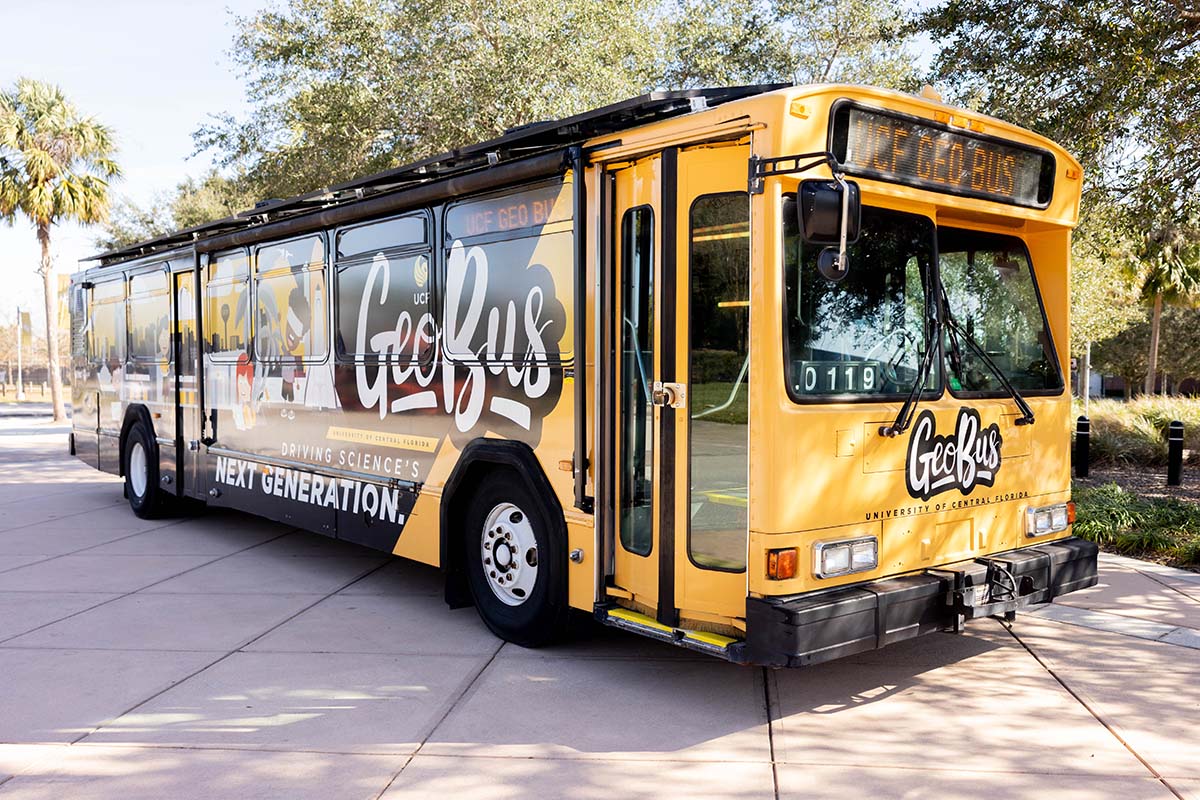
GIS education is traditionally taught in university settings, but Hawthorne is determined to help local schoolchildren learn about it sooner. With the global reliance on geospatial technology — such as GPS, drones and lidar — rapidly increasing, GeoBus aims to introduce children to the unlimited opportunities that lie within this in-demand field. The bus’ blueprint was created from scratch with contributions from several national and local partners.
In September 2018, Central Florida bus service LYNX donated a 40-foot retired vehicle to support the effort. The bus service saved the team thousands of dollars by removing 55 of the 64 seats and covering the cost of the GeoBus’ exterior wrap. The vibrant, kid-friendly design is adorned with curious young scientists, topographic lines and well-known Orlando and UCF landmarks like Kennedy Space Center and FBC Mortgage Stadium.
With GIS being a major tool in supporting sustainability efforts, an element of energy efficiency was needed. Founder and CEO of 15 lightyears Lisa Pearcy ’04, a UCF marketing alumna, and her crew constructed and installed an intricate solar wall, plus 12 solar panels that sit atop the bus roof, at no cost. Although it’s still a diesel bus at heart, when parked the interior lab of the bus can run for eight or nine hours only on solar energy.
Through weekly 90-minute sessions, K-12 students transform into youth scientists aboard the bus. As they look up, their eyes are met with mapping graphics, similar to subway station maps, that guide them along the 10 hands-on indoor and outdoor learning stations. From flying drones over small maps and taking simulated trips around the world through virtual reality headsets, to examining 3D model landscapes and using block coding to navigate robotic balls across a map, students learn the power of geospatial technologies from UCF students and faculty.
The GeoBus reached 2,500 students across Central Florida in 2022, providing them with tools to actively engage in science while also encouraging them to initiate change in their own schools.
A sixth-grader was so inspired by the GeoBus’ augmented reality sandbox station — which uses an Xbox connect sensor and projector to show the changes in elevation within a kinetic sandbox — he advocated to add a similar setup to his school’s STEM lab. The hands-on learning component at Viera Elementary School extends the GeoBus’ impact for current and future students to explore.
A big bus with big impact, the GeoBus’ high demand is credited in part to a shift in post-pandemic learning to educational experiences outside of the classroom.
“There was a really big push [to] bring [these experiences] back and those outside voices about science into the schools again,” Hawthorne says.
Requests are pouring in from Central Florida, areas in Miami, the Florida Keys and St. Augustine, which means the GeoBus team must expand to meet its demand. Hawthorne is working on securing a commercial driver’s license, stopping at nothing to bridge science, technology and communities.
“It’s been a long process,” Hawthorne says, “but we keep coming back to the why: [getting] kids excited about science.”
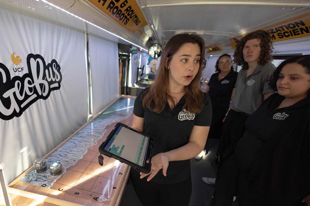
Graduate sociology student Halley Spencer ’21 explains the sphero ball activity where students use block coding to move a ball across a map. (Photo by Kadeem Stewart ’17)
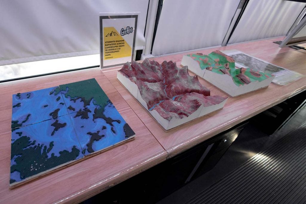
Through comparing and contrasting 3D model landscapes, students gain a better understanding of elevation and various landform structures. (Photo by Kadeem Stewart ’17)
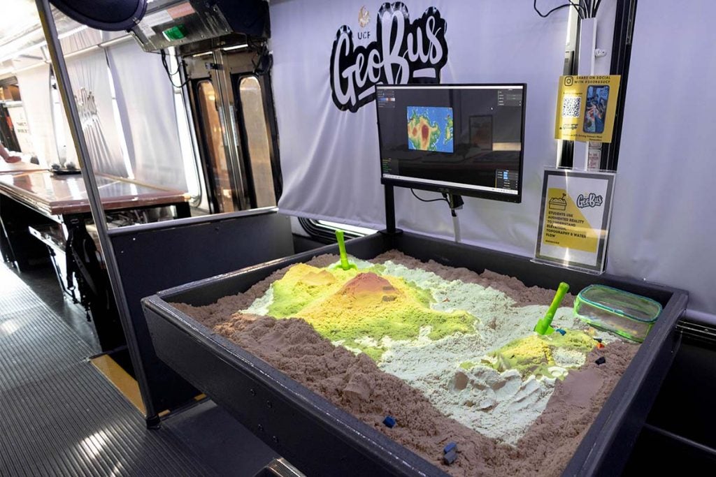
[The AR sandbox] is definitely students’ most favorite [activity] on the bus,” Tim Hawthorne says. “It’s the most photographed one.” (Photo by Kadeem Stewart ’17)
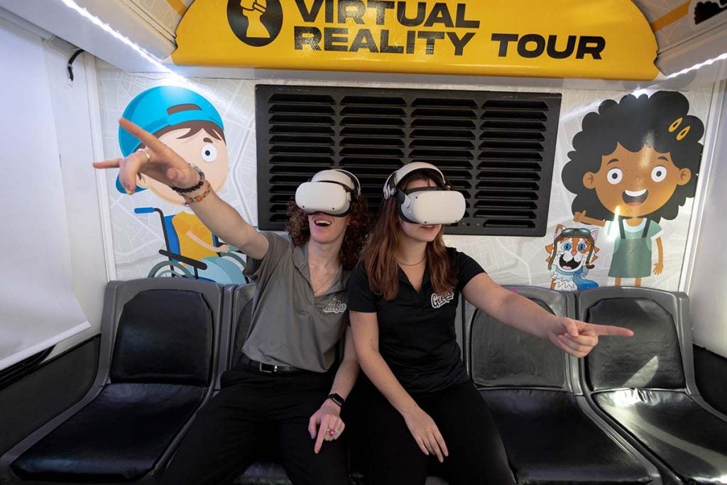
The virtual reality learning station whisks students away to different places around the world, giving them a 360-degree view while they learn about ocean systems, wildlife and more. (Photo by Kadeem Stewart ’17)
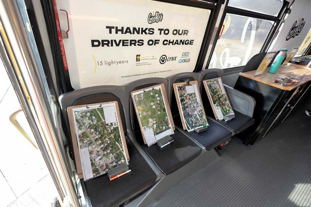
Students are able to explore drone imagery from some of the Citizen Science GIS’ fieldwork, and use dry-erase markers to add elements such as legends and scale bars to the maps. (Photo by Kadeem Stewart ’17)