
The Story of the Pan-American Highway
Summer 2019 | By Maureen Harmon
It was a footnote in a random book in Central America that sent Eric Rutkow — lawyer, author and UCF assistant professor of history — on one of the biggest journeys of his life. The footnote was a nod to the construction of the Inter-American Highway — 3,400 miles of road that stretches from Mexico to Panama. But what Rutkow found so interesting was the mention that this stretch of highway was the United States’ largest global development project between the world wars.
Even though he was deep in graduate work at Yale and had been studying U.S.-Latin American relations for years, this was news to him. And, really, it was news to most who consider large-scale U.S. global development programs — from the Marshall Plan to USAID — as wholly post-World War II phenomena, save the Panama Canal, which got its start in 1903.
“I’d never seen that anywhere,” says Rutkow. “I always get excited when things don’t fit the narrative. The U.S. was supposed to be very isolationist in the 1920s, and then the Great Depression happened. So this really shifted the whole narrative.”
Rutkow’s original plan was to use that footnote as a starting point for his grad school dissertation, which would make the case that the U.S. was bridging infrastructure relationships with South America long before we thought. But the project soon became a network of tales — 100 years’ worth.
“I discovered that it was just the center of a huge story that had been totally missed, which is that, for a century, it had been U.S. policy — sometimes at the highest, most overt levels, sometimes in complicated ways involving private actors — to try to connect North and South America,” says Rutkow.
With the assistance of the Yale library, the National Archives in Washington, D.C., the American Heritage Center in Wyoming, and oral histories and diaries from several countries, Rutkow wrote his dissertation, and eventually his book The Longest Line on the Map: The United States, the Pan-American Highway, and the Quest to Link the Americas. In it, he tells the tale of the political battles, the economics, the terrain that made it nearly impossible, and the unfinished road that exists today.
But this isn’t the story of Rutkow’s book or a road. It’s the complicated history of what the Pan-American Highway symbolizes: a century’s worth of hemispheric relations — and where we are today.
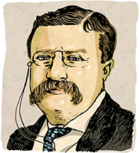
“We may assume that … the volume of our trade with South America will soon grow to large proportions. These means are: Adequate transportation facilities, such as steamship lines, railroads, and isthmian canal; reciprocal trade relations; participation in the business of banking, and a corps of commercial travelers specially equipped for Latin-America trade. It is not impossible that, following such development, the magnificent conception of an international railroad connecting the United States with the remotest parts of South America may at last be realized.”
President Theodore Roosevelt, October 1901
The plans for land travel between the Americas started on a boat. The idea was hatched by a seasick Hinton Rowan Helper, the U.S. consul to Argentina, as he traveled from Buenos Aires to New York in late 1866 by way of the Lord Clarendon. It was the spark of an idea — an intercontinental railroad — that would launch 100 years of planning and politics and policy to bridge the continents, opening room for trade and mutually beneficial relations between the Americas.
Contrary to what historians have believed so far, says Rutkow, America’s first steps toward globalization found their footing on this railroad dream. “Pan-Americanism is not simply just this naked excuse for imperialism. It’s a very complicated phenomenon,” says Rutkow. “It’s very real, and it’s America’s first international relations of any consequence.”
The relationship over the past century has been complicated, to say the least. For some parts of Latin America, the relationship with the U.S. was diplomatic. For others, not so much.
“When it comes to Pan-Americanism,” says Yovanna Pineda, UCF associate professor of history, “Latin America is a very different place. In Central America, Pan-Americanism is seen as imperialistic, but as you get into Brazil and Argentina it becomes more diplomatic.”

And many of those U.S.-Latin American relations started with a railway dream. That railway never came to pass, but it led to a new route to connect the Americas: what would become known as the longest road in the world, stretching 19,000 miles from Alaska to the tip of Argentina.
Yet it’s the Panama Canal that gets all the Pan-American attention in the history books.
“I know 10 books right now all on the Panama Canal,” says Pineda. “It was such a huge venture, and also from the Latin American side, you see how many people actually died during the making of it. In a way, it was kind of like building the Great Wall of China.”
In the midst of all the literature on the canal — the politics, the race relations, the tragedies — the Pan-American Highway got lost.
“The road rarely received more than a passing mention in any of the literature,” says Rutkow, “and the more I searched, the more elusive the road seemed to become.”
There exists no clear definition of the Pan-American Highway, and the United States doesn’t officially recognize it today as such (though that’s what most travel bloggers and National Geographic writers will call it). Even travelers of the road don’t always know they’re on it.
“If you travel between capital cities, basically anywhere in Latin America, you’ll often find yourself on the Pan-American Highway,” says Rutkow. “Generally, the Pan-American Highway is just Highway 1 or 2 of the national system in most of South America.”
Information about the road itself is limited. Aside from the length of the road and the variety of terrains it crosses (from jungles to deserts to mountains to beaches), and the types of cultures you might encounter along the way, it is simply a road traveled, and certainly not often in its entirety. Some label the road as “the ultimate road trip.” As one travel blogger puts it: “Why settle for an ordinary road trip when you can drive across the Americas?”
But the road, for Rutkow, represents something much larger: The Pan-American Highway is the end result of negotiations, policies and ideas that started with a railway in the 1800s. Today, for Rutkow, the highway is a concrete example that we were wading into, and funding, international infrastructure decades before we thought.
Rutkow’s book, argues Gilbert Joseph, Farnam professor of history and international studies at Yale and Rutkow’s dissertation advisor, details a “missionary impulse to connect the hemispheres by roads, by railroads and then byways. … [Rutkow] is giving us many ways of looking at U.S. power that is personified by the Pan-American Highway.”
The footnote that Rutkow discovered in that book in Central America became a thread on which he pulled to unravel the plan for a railway and eventually the creation of the highway. And the discoveries Rutkow found along the way were surprising. The road itself was partly funded by New Deal funds, for example — a deal most consider a domestic policy.
“Franklin Roosevelt ended up having such an important role in pushing this forward right at a moment when it had no need to be,” says Rutkow. “I mean, it’s the Great Depression, and he’s the one demanding this happens.”
America had created the infrastructure for roads, and the automobile industry fueled that infrastructure — and now the government and private entities wanted to expand their reach. That reach is evident in American mega industry sites — spots of private enterprise sprinkled along the route.
“The Pan-American Highway is the end result of negotiations, policies and ideas that started with a railway in the 1800s. Today, for Rutkow, the highway is a concrete example that we were wading into, and funding, international infrastructure decades before we thought.”
“Some of those sites have since been abandoned,” says Rutkow, “some have changed hands.” But the site he found most fascinating on his own journey was the Chuquicamata copper mine north of Santiago, Chile. “At one time, it was one of the biggest physical holes in the world and is still one of the major copper producers,” he says.
But for Rutkow’s interests, the most telling nugget of information is that the mine — a three-mile-long hole that’s been dug for a century — was privatized by the Guggenheims before World War I. American private industry in a spot that history — up until now — has largely overlooked.
The Pan-American Highway was 30 years in the making after the Americas tried and failed to create the intercontinental railway system. It took five Pan-American conferences, a world war, the birth of the automobile industry in the U.S., and the knowledge of the infrastructure required to get the autos from place to place before the American highway system could begin to snake its way south. But the ride wasn’t always smooth.
Even after 100 years of Pan-American relations, the road — with all the political wrangling, private enterprise, and hopes and dreams that went into it — is still incomplete. The Darién Gap — about 60 miles of territory located between Panama and Colombia that has been shrouded in mystery, danger, and now very tentative tourism for those who want credit for passing through one of the world’s most dangerous areas unscathed — remains unfinished.
The Darién Gap
Between Panama and Colombia lies 60 miles of territory shrouded in mystery, danger and very tentative tourism for those who want credit for passing through one of the world’s most dangerous areas unscathed. As part of his research, Rutkow visited the veritable no-man’s land to gather live interviews with indigenous people and Panama’s Security Force, among others, in order to tell the story of this still-incomplete stretch of the Pan-American Highway.

Illustrations By John S. Dykes
The terrain — and the jaguars and snakes that inhabit it — has kept the area unpaved. And the absence of cars, infrastructure, highway and trade has given way to guerillas, drugs and migrants willing to risk the journey. In all the idealism that brought the road this far, U.S.-Latin American relations now, in many ways, sit in the gap.
“It’s a fabled, legendary no man’s land that’s bedeviled the most storied adventurers, members of the American military and legions of would-be migrants. But it doesn’t put them off. Even today, tens of thousands of migrants a year risk their lives to cross it,” wrote Adam Yamaguchi for CBS when he ventured to the gap to make the trek with a migrant named Shahab Shahbazi.
There are some who come to the gap in the road for adventure. And some, like Shahbazi, who come for much more: the promise of a better life in the U.S. — a country embattled in its own interior war of allowing people like Shahbazi in or keeping people like Shahbazi out.
Rutkow knows this road like no one else. He knows the lengths that the United States went to make it happen both publicly and privately. He has traveled to the Darién Gap to talk with the people who live nearby, to gather oral histories, to walk the land, and to befriend the hikers and adventurers he met along the way.
The tale of the longest line on the map, he says, isn’t just the tale of a road. It is the tale of every deal and policy made between the Americas, from those initial talks about a railway all the way to President Barack Obama’s move to warm up diplomatic relations with Cuba and President Donald Trump’s plans for the future.
It is the tale of a road, yes, but also the tale of a railway, a canal and now, perhaps, a wall. Rutkow isn’t necessarily interested in the political arguments for or against such a project. He certainly has an opinion as an American, but as a historian, it’s simply another note in history — a new twist in the road of U.S.-Latin American relations.
And we will see where it takes us.
By The Numbers
A look at a few facts and figures that make up the Pan-American Highway.

19,000
The estimated number of miles covered by the Pan-American Highway, which starts in Prudhoe Bay, Alaska, and stretches to the tip of Argentina in Ushuaia.

14
The number of countries through which the highway runs.
60+
The number of miles of the Pan-American Highway that remain incomplete. This dangerous section of the route is called the Darién Gap.

The number of days cyclist Carlos Santamaría Covarrubias logged to own the Guinness world record for “fastest cycle journey of the Pan-American Highway.”
The number of U.S. entry points on the original route of the highway. Early travelers accessed the Pan-American Highway in the north through Washington and in the south through Texas.

11,322The elevation on what is considered one of the highest points of the road in Costa Rica. This peak is called Cerro de la Muerte — or Summit of Death, a throwback to early crossings before the highway made travel a little more accessible.
2,426
Number of days George Meegan logged to earn the Guinness world record for traveling the road fastest on foot.

$2,415
Cost, in gasoline, to travel the road in its entirety (assuming a $3 per gallon cost)