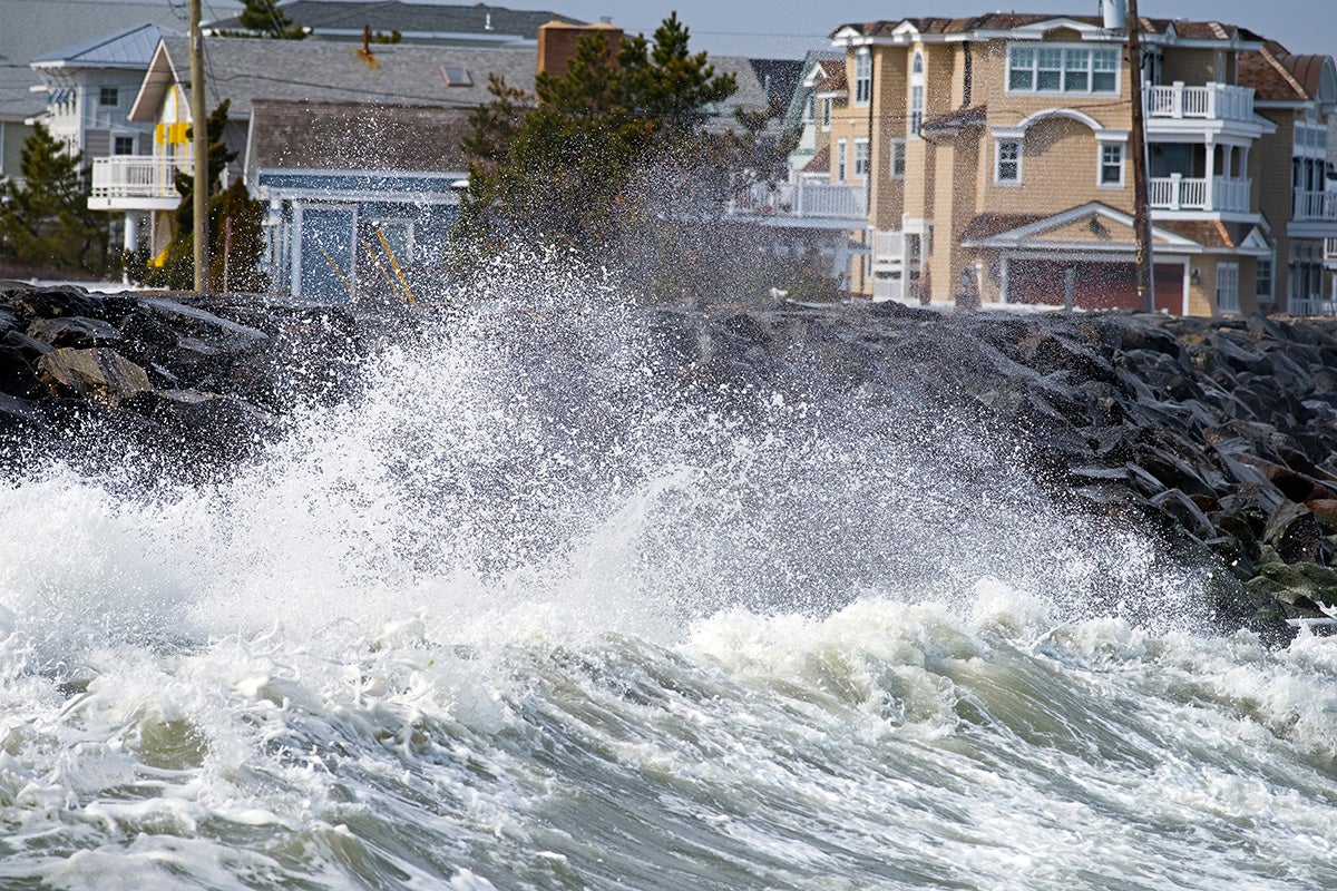
Extreme weather events, such as the storm waves generated by the cyclone that recently moved across California, may be underestimated in many models used to estimate coastal flooding, according to a new study led by University of Central Florida researchers.
The study, which was published this week in the journal Science Advances, shows that models used across the globe to estimate the height of coastal storm waves —critical information when building ports, reinforcing infrastructure and estimating flooding — can differ by several feet, leading to some areas being possibly under protected during extreme wave events.
The first-of-its-kind study compared wave estimates from 12 global models with historical buoy observations across different ocean areas.
It found that existing models can reliably represent historical buoy observations across many areas, but no model performs well everywhere and estimates of extreme wave heights can vary between models by up to approximately 20 feet at places.
The study shows that such discrepancies largely exceed current projected 21st changes in coastal extreme wave storm events under a high-emission scenario (9 degrees Fahrenheit in warming by 2100).
“Extreme wave events pose a major risk to offshore-coastal infrastructure and can dramatically affect global coastlines and natural ecosystems through widespread flooding and erosion,” says Joao Morim, a coastal researcher in UCF’s Department of Civil, Environmental, and Construction Engineering and the study’s lead author. “Understanding their magnitude and frequency for today’s weather is required for offshore and coastal designs and risk assessments, and it’s essential to assess potential future changes.”
Morim says due to a lack of observations with global coverage, wave models are typically used for many different applications, such as coastal flood risk assessments.
“We show that depending on the product used, estimated flooding can vary by several feet,” Morim says.
The researchers found that to more accurately assess offshore and coastal risk and inform future mitigation and adaptation responses, decision and policy makers must account for differences between global wave models and take into account observation measurements based on today’s weather.
This means considering different models and using additional, modern observational data to better constrain extreme wave estimates under current weather conditions.
This should be done before considering changes due environmental changes and sea level rise, which is the main focus of many of the current global and regional flood risk assessments, the researchers say.
The additional data could include long-term observational records from satellite missions and more data from buoys.
“I feel that our results provide a clear message that published broad-scale offshore and coastal risk assessments for present and future weather using extreme wave data taken from specific global and regional wave model products can be misleading and need to consider multiple products to fully assess offshore-coastal impacts and make robust conclusions,” Morim says.
“The results, which are surprising given that current differences between models can differ by several feet, show that we need to consider uncertainties in extreme wave event estimates now while also addressing projected future changes,” he says.
For Florida, there are considerable uncertainties concerning wave flooding estimates for the west coast of the state, stemming from the wave models analyzed and the discrepancies between them, which partly result from their different ability in resolving extremes wave storms due to tropical cyclone, the study shows.
“We feel that our research improves our current knowledge and makes a clear point that no uncertainty can be neglected when considering global and regional adaptation,” Morim says.
Study co-authors were Thomas Wahl, an associate professor in UCF’s Department of Civil, Environmental and Construction Engineering; Sean Vitousek with the Pacific Coastal Marine Science Center, U.S. Geological Survey; Sara Santamaria-Aguilar, a postdoctoral researcher in UCF’s Department of Civil, Environmental, and Construction Engineering; Ian Young with the Department of Infrastructure Engineering, University of Melbourne, Parkville, Victoria; and Mark Hemer with the Commonwealth Scientific and Industrial Research Organisation (CSIRO) Oceans and Atmosphere, Hobart, Tasmania, Australia.
The research was funded with support by the UCF Pre-eminent Postdoctoral Program; the NASA Sea Level Change Team; the U.S. National Science Foundation; the U.S. Geological Survey; the Australian Research Council; the Australian Commonwealth National Environmental Science Program and CSIRO’s Climate Science Centre.
Morim received his doctorate from Griffith University on the Gold Coast, Queensland, Australia. He joined UCF in 2021.
Wahl earned his doctorate in civil engineering from the University of Siegen, Germany, and joined UCF’s Department of Civil, Environmental and Construction Engineering, part of UCF’s College of Engineering and Computer Science, in 2017. He is also a member of UCF’s National Center for Integrated Coastal Research and Sustainable Coastal Systems faculty cluster.
Study title: Understanding uncertainties in contemporary and future extreme wave events for broad-scale impact and adaptation planning