No matter the best-laid plans or the time spent preparing for a natural disaster, there is almost certain to be some element of response or recovery that is overlooked, usually by virtue of resource constraints.
With that in mind, University of Central Florida School of Public Administration Professor Christopher Emrich and his team of graduate and postdoctoral researchers set out to the city of Cape Coral, Florida, after Hurricane Ian in September to collect critical impact data.
Their goal was to provide empirical evidence on where exactly hurricane storm surge flood waters reached throughout the city during the storm’s peak, which is essential data needed when planning for recovery and mitigating future storm impacts.
Cape Coral was one of the areas hardest hit by Hurricane Ian as it made landfall in Southwest Florida in September.
Emrich’s team identified the resource gap almost immediately. The U.S. Geological Survey, which was already on-site conducting survey missions to collect data in several areas, was not tasked to collect high-water mark data from communities affected by flooding in the municipality of Cape Coral.
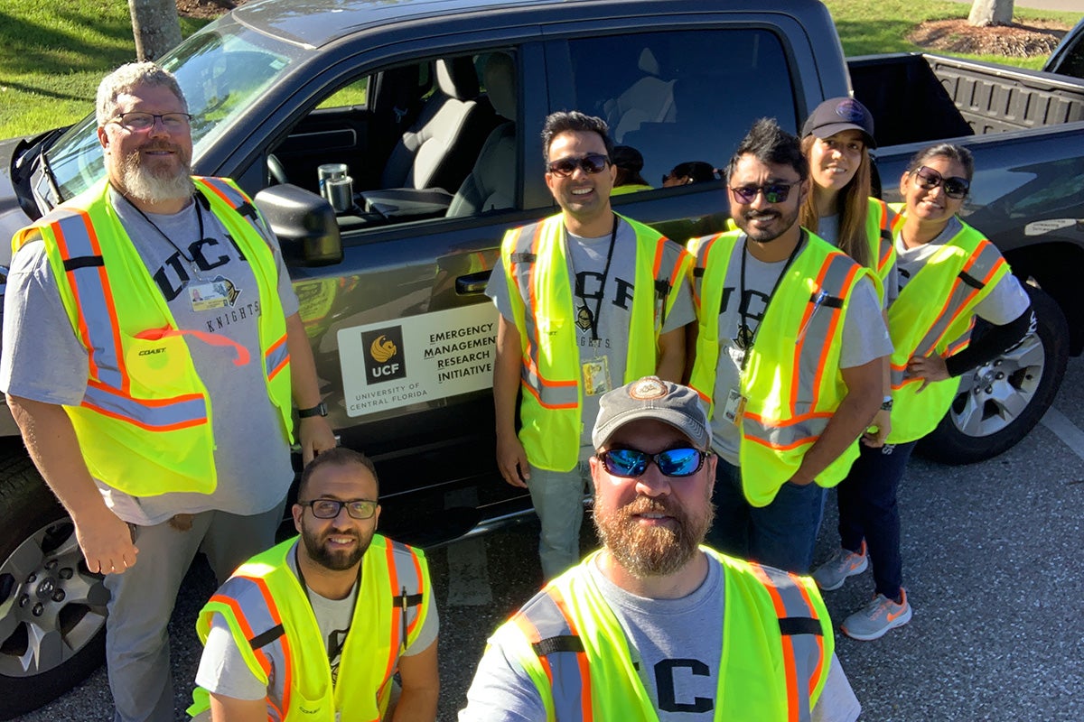
Seeing an opportunity to conduct field research that would be beneficial to the city’s local officials, Emrich worked directly with UCF’s Office of the Provost and the city’s administration to get into the field before flood marks were either washed away or cleaned up by disaster survivors.
Using the designation UCF Emergency Management Research Initiative, Emrich assembled students and postdoctoral scholars from UCF’s Sustainable Coastal System’s Cluster (one of UCF’s Faculty Cluster Initiatives) — including Gene Longenecker, the former Federal Emergency Management Agency’s Modeling Task Force lead.
“We need to know empirically –– scientifically –– where the water was, because it’s a critical step for planning,” Emrich says. “To find this data, we had to get creative.”
Emrich says collecting this data is also time-sensitive because of residents’ desire to clean up immediately after a storm and future rain events can erase the evidence they are looking for.
Starting with data on Federal Emergency Management Agency assistance requests already summarized by FEMA at the U.S. standard 1-kilometer national grid level, the team’s mission focused on identifying areas of flood damage and existing gaps in high water mark collection by other agencies and entities.
Over the course of six days, the team traveled across Cape Coral identifying debris lines, seed lines and other clues on mostly public and vacant land to flag and measure high water marks throughout the city. Emrich’s team flagged more than 150 high water marks using direct measurements.
Emergency management professionals are already reaping the benefits of the team’s labor, as their data will become part of the official USGS database for immediate access by anyone interested in undertaking flooding, hydrology or storm surge modeling.
Surveyors from the city of Cape Coral revisited flagged high water-mark data collection sites to provide survey grade measurements, a step which Emrich says is critical to ensuring the team’s data can be used by the most people — from emergency managers to hydrologists and others interested in improving storm surge models.
“We want to see how our perishable situational data compares to scientifically measured survey grade data,” he says. “If the data we collect are accurate enough for local professionals to use in future planning, it means the data we can collect quickly in future disasters become that much more useful.”
Emrich says he aims to continue building on the success of the mission in Cape Coral to create a standing, deployable team that government at all levels can call upon to conduct rapid data collection missions anywhere in Florida.
“After every tornado, the National Weather Service sends out a team to conduct a survey,” Emrich says. “We want to be the team that can do that for every flooding event in Florida. Somebody needs to measure the qualitative and quantitative impacts that would otherwise be lost after those events. We cannot create effective, efficient and accurate plans for disaster recovery without baseline information on hazard exposure.”
He adds that the initiative is about more than simply collecting data.
“We want to take the information we collect and use it to answer tough scientific questions that we can turn into wisdom for emergency management professionals,” Emrich says. “When people look at the impact of a disaster, they first look at the amount of federal aid distributed. For various reasons, federal datasets only tell part of the story, even from a financial perspective. We want to help paint the full picture so the professionals in the field can make the best decisions for their communities as they move from response to recovery.”
Emrich received his doctoral degree in geography from the University of South Carolina and joined UCF’s School of Public Administration, part of the College of Community Innovation and Education, in 2016. Emrich also leads UCF’s Sustainable Coastal Systems research cluster and co-leads UCF’s National Center for Integrated Coastal Research.